Gallery:County Cork

From Roader's Digest: The SABRE Wiki
Jump to navigation Jump to search


This gallery has no child categories
County Cork
 
 
The M8 (Ireland) 4 km south of Mitchelstown, County Cork - Coppermine - 22254.jpg
The M8 (Ireland) 4 km south of Mitchelstown, County Cork Originally uploaded to Coppermine on May 24, 2009 by Furet
The M8 M-F scheme at junction 12 looking south - Coppermine - 21429.jpg
The M8 M-F scheme at junction 12 looking south

13 February 2009. CBM being laid. This is laid, rolled, and then water-proofed with a black coating. The CBM hardens quickly. Three layers of asphalt are then applied.

Originally uploaded to Coppermine on Feb 17, 2009 by Furet
The M8 under construction north of Mitchelstown. - Coppermine - 21120.jpg
The M8 under construction north of Mitchelstown.

Taken in December 2008, this shows part of the 16km Mitchelstown to Fermoy scheme, looking southwards, south of junction 12.

Originally uploaded to Coppermine on Dec 27, 2008 by Furet
The M8 under construction at junction 13, south of Mitchelstown. - Coppermine - 21121.jpg
The M8 under construction at junction 13, south of Mitchelstown.

This shows the section under construction in December 2008. The overbridge is carrying the single carriageway N8. When the motorway beneath opens, the road above will be reclassified the R639.

Originally uploaded to Coppermine on Dec 27, 2008 by Furet
R605 Kinsale.JPG
Corner of Pearse Street and The Glen, Kinsale
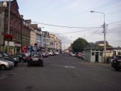
Youghal Road, Middleton - Geograph - 4910478.jpg
Youghal Road, Middleton A very busy town, particularly so at commuter time.
Service station - Geograph - 4171754.jpg
Service station Minimarket and service station in Ladybridge on the R632.
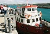
The Glenbrook to Ballynoe Ferry - Geograph - 595371.jpg
The Glenbrook to Ballynoe Ferry
M8 Mitchelstown to Fermoy scheme, 1 May 2009 - Coppermine - 22115.jpg
M8 Mitchelstown to Fermoy scheme, 1 May 2009 Originally uploaded to Coppermine on May 01, 2009 by Furet
New section of the N8 - Geograph - 574679.jpg
New section of the N8 Rare dual carriageway by-passing Fermoy and Rathcormack on the main Cork to Dublin route.
N71 road- In, er, County Cork - Geograph - 265670.jpg
N71 road- In, er, County Cork The actual county boundary between Cork and Kerry runs through the summit tunnel to the north of this and behind the photographer.
View from bridge over N28 - Geograph - 4871188.jpg
View from bridge over N28 Looking towards Cork, this is the view of the N28 road to Carigaline and Ringaskiddy ferry port.
20161023-12201 - R585 Road Bowling near Bealnablath, Co Cork.jpg
Road Bowling on the R585 near Bealnablath, Co. Cork
20161023-14291 R585 - Road Bowling near Bealnablath, Co Cork.jpg
Road Bowling near Bealnablath, Co Cork.jpg
20161023-1443 - R585 heading east - 51.7822063N 9.1045366W.jpg
R585 heading East in County Cork
20161023-1443 - R585 heading west - 51.7822063N 9.1045366W.jpg
R585 heading west in County Cork
20161023-1443 - Road sign where L4616 meets R585 - 51.7822063N 9.1045366W (2).jpg
Road sign where L4616 meets R585
20161023-1455 - R585 East of Cousane Gap - 51.7579282N 9.2529205W (2).jpg
20161023-1455 - R585 East of Cousane Gap
20161023-1455 - R585 East of Cousane Gap - 51.7579282N 9.2529205W.jpg
R585 East of Cousane Gap
20161023-1511 Single track road 51.7563056N 9.3411199W.jpg
Single track road near Kealkill
20161023-1522 - Junction of the R584 and R585 at Kealkill, Co Cork - 51.7485608N 9.3860848W.jpg
Junction of the R584 and R585 at Kealkill, Co Cork
20161023-1526 - R584 bridge by Carriganass Castle, Kealkill, Co Cork - 51.7536743N 9.3787922W.jpg
R584 bridge by Carriganass Castle, Kealkill, Co Cork
20161023-1527 - R584 bridge by Carriganass Castle, Kealkill, Co Cork - 51.7536743N 9.3787922W.jpg
R584 bridge by Carriganass Castle, Kealkill, Co Cork
20161023-1619 - R572 south of Glengarriff - 51.7465163N 9.5530586W.jpg
R572 south of Glengarriff
20161023-1635 - Long Irish L Road name plate at junction with R572 (51.681538N 9.7005469W).jpg
Long Irish L Road name plate at junction with R572
20161023-1626 - R572 layby - 51.7149102N 9.5805258W.jpg
Layby on R572
20161025-1500 - Bantry 51.6800564N 9.4524384W.jpg
Bantry - Wolfe Tone Square and New Street
20161027-1210 - Dursey Island - 100kmh sign - 51.591633N 10.204402W (2).jpg
Dursey Island - 100kmh sign
20161027-1503 - Sign giving distances to New York and Moscow - 51.6100055N 10.1549056W.jpg
Sign giving distances to New York and Moscow
20161027-1440 - Dursey Island - cable car to the mainland 51.607755N 10.158200W.jpg
The end of the R572 over the other side of the narrows from Dursey Island, with the cable car in view
20161024-1509 - Adrigole Lay By Sign - 51.694283N 9.720861W.jpg
Lay by sign and Wild Atlantic Way Route confirmation Sign, Adrigole, Co. Cork
20161024-1433 - Adrigole - Road Sign approaching R572 R574 junction - with aerial 51.6936155N 9.7241039W.jpg
Road Sign approaching R572 R574 junction (with TV aerial), Adrigole
20161024-1435 - Adrigole - R572 Junction Ahead - 51.6942449N 9.7226431W.jpg
Junction on bend over bridge ahead sign
20161026-1116 - The Healy Pass - Information Sign.jpg
Healy Pass - Information Sign
20161026-1116 - Cross on the Healy Pass.jpg
Shrine on the Healy Pass
Saint Patrick's Street, Cork - Geograph - 411592.jpg
Saint Patrick's Street, Cork
The N25, County Cork - Geograph - 1846317.jpg
The N25, County Cork
Priest's Leap. - Geograph - 249332.jpg
Priest's Leap. The cross at the summit of the pass and a view of the gentler Cork side of the pass.
Sherkin Island ferry quay - Geograph - 242744.jpg
Sherkin Island ferry docked at Sherkin Island
Brittany Ferries Pont Aven ready to cast off - Geograph - 3666316.jpg
Brittany Ferries Pont Aven ready to cast off
20180824-1908 - The MV Connemara in Ringaskiddy port prior to sailing for Santander (photo taken from the High Road at Cobh 51.848514N 8.303846W).jpg
The MV Connemara in Ringaskiddy port prior to sailing for Santander (photo taken from the High Road at Cobh)
20180824-2151 - View of Cobh, sailing out of Ringaskiddy 51.841397N 8.271727W.jpg
View of Cobh, sailing out of Ringaskiddy
Belvelly Bridge, Belvelly Townland - Geograph - 1901896.jpg
Belvelly Bridge, Belvelly Townland This bridge is the only fixed access onto Great Island, where Cobh is the major town. The other end of the bridge goes onto Fota Island before crossing another bridge onto the main land near the N25. There is also the Cross River vehicle and passenger ferry between Rushbrook and Passage West.
20180824-1905 - Fingerpost with distance to Cork on R624 at Casement Square, Cobh 51.850211N 8.294873W.jpg
Fingerpost with distance to Cork on R624 at Casement Square, Cobh
20180824-1904 - R624, Cobh 51.850211N 8.294873W.jpg
R624 at Cobh
20180824-1502 - St Patricks Bridge, Cork 51.900932N 8.469992W.jpg
St Patrick's Bridge, Cork, looking west from St Patrick's Quay
20180824-1914 - The pier at Carrigaloe 51.861705N 8.326263W.jpg
The pier at Carrigaloe looking over at the MV Carrigaloe
 

SABRE - The Society for All British and Irish Road Enthusiasts
Discuss - Digest - Discover - Help