A-Z Mapping
Jump to navigation
Jump to search
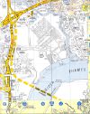
| Pictures related to A-Z Mapping View gallery (39) |
A-Z maps were created by Phyllis Pearsall in 1936 to provide a street-atlas of London with EVERY street marked! The company was originally called Geographers Map Co, with A-Z added in 1972. After the war expansion led to other cities being covered, and today almost all of the towns and cities in the UK have an A-Z Street Atlas. For the full history, see the A-Z website.
Today the company also produces a range of large-scale road atlases for the UK.
| Year From | Year To | Map Name | Scale | Notes |
|---|---|---|---|---|
| 1936 | present | A-Z London | various | The original A-Z map |
| ? | present | A-Z Birmingham | various | One of the first additions after the war |
| ? | present | A-Z Manchester | various | One of the first additions after the war |
| A-Z Mapping | ||||||||
| ||||||||
|


