Star grey.pngStar grey.pngStar grey.pngStar grey.pngStar grey.png

OS Routemaster

From Roader's Digest: The SABRE Wiki
Jump to navigation Jump to search
Routemaster
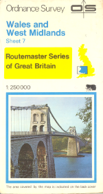
OS RM7 WalesWestMidlands 1978.PNG
Cameraicon.png View gallery (6)
Publisher:  Ordnance Survey
Scale:  1:250,000
First Published:  1978
Final Publication:  1993
SABRE Maps layer:  No

The Ordnance Survey Routemaster series of mapping was a replacement for the Quarter Inch map series at 1:250,000 scale.

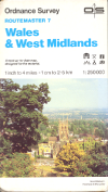
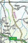
Routemaster sheets covered a larger area than the previous Quarter Inch maps, with 9 sheets covering the whole of Great Britain, rather than the previous 17 sheets. They were also the first OS map series to have photographic covers, and from 1980 also showed Primary Destinations.

The series was replaced by the Travelmaster series in 1993.

SABRE Maps coverage

The earliest OS Routemaster was published in 1978, and so will not be out of copyright until 2029. It cannot, therefore, appear on SABRE Maps until that date.


OS Routemaster
Related Pictures
View gallery (6)
OS RM7 WalesWestMidlands 1978.PNGOS RM7 WalesWestMidlands 1989.PNGA1198 - OS Atlas 1991 - Coppermine - 175.jpgB3219.jpgA36(M) - Coppermine - 4391.jpg
Road Mapping
Ordnance SurveyMoT Maps • Ten Mile Road Map • Route Planning Map • One Inch(Popular Edition) • 1934 London PT • Landranger • Half Inch • Quarter Inch • Routemaster • Travelmaster • Road Map • Travel Map • Pathfinder • Explorer  • Outdoor Leisure • Tourist • Ten Mile • City Link • City, Town and Neighbourhood • Miniscale • OS Great Britain
Ordnance Survey Northern IrelandRoad Map • One Inch • Discoverer
Ordnance Survey IrelandDiscovery • Half Inch
Other MappingA-Z • AA • Bartholomew • Book of the Road • Google • Michelin • Philips • Others


SABRE - The Society for All British and Irish Road Enthusiasts
Discuss - Digest - Discover - Help