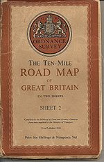
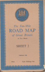
Ten-Mile Road Map of Great Britain
| Ten Mile Road Map | |||
 | |||
| |||
| Publisher: | Ordnance Survey | ||
| Scale: | 1:625,000 | ||
| First Published: | 1932 | ||
| Final Publication: | 1963 | ||
| SABRE Maps layer: | Yes | ||
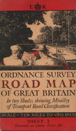
The Ten-Mile Road Map of Great Britain (or simply Ordnance Survey Road Map of Great Britain) series were official maps showing classified roads.
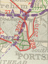
The maps were conceptually similar to the earlier Ministry of Transport Road Maps in that they were standard OS sheets with a specific overlay - on the 1930s maps for example, 'A' roads were overlaid red, and 'B' roads in blue. As in the MOT Road Maps, they displayed as many classified roads as were practical, although their larger scale meant that shorter link roads were less well marked. On the 1946 map and later, Trunk Roads were also marked, initially in purple and later in black.
They covered Great Britain in two sheets, with Sheet 1 covering Scotland, and England south to roughly a line joining Ravenglass on the Cumberland coast with Ravenscar on the Yorkshire side; though the exact location of the sheet changed changed after the 1948 edition, with Ravenglass being on Sheet 1 prior to that date, and Sheet 2 after. Some urban areas (depending on the map) were given expanded coverage, with only Glasgow and London being shown on the 1946 edition.
The first set of maps were published in 1932, with annual editions following during the 1930s and irregularly thereafter - though not all editions featured both sheets. The 1948 edition, for example, only has Sheet 2, with no equivalent Sheet 1. In 1964 they were replaced by the Ordnance Survey Route Planning Map at the same scale.
The editions prior to the end of World War 2 used the OS National Yard Grid, whilst from the 1946 edition, the maps started to show the more familiar metric OS National Grid, although the 1946 and 1948 editions were on a base map that was originally to National Yard Grid lines, as can be seen from the non-round grid references in the corners.
The series should not be confused with the Ten Mile Map series at the same scale.
The equivalent maps for Northern Ireland are the Road Map of Northern Ireland.
SABRE Maps coverage
SABRE Maps has full coverage of the 1932, 1936, 1937, 1939, 1944, 1946 and 1956 editions (and the proof edition from 1955) as well as single sheets from the 1933, 1934 and 1948 editions.
| Ten-Mile Road Map of Great Britain | ||||||||
| ||||||||
| ||||||||
|
