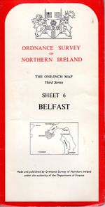
OSNI One Inch
Jump to navigation
Jump to search
| OSNI One Inch | |||
 | |||
| |||
| Publisher: | Ordnance Survey of Northern Ireland | ||
| Scale: | 1:63500 | ||
| First Published: | 1910 (1st series) | ||
| Final Publication: | 198? | ||
| SABRE Maps layer: | Yes | ||
The OSNI One Inch maps were the main maps of the Ordnance Survey of Northern Ireland.
The first 1" series was in 1910, the second was the "Popular" Edition (not to be confused with the British series of the same name) concurrent with the 5th series, and the third concurrent with the British 7th series.
Covers
The covers of OSNI One Inch maps in the 1970's were very similar to the British Ordnance Survey own One-Inch maps of the 1950 and early 1960's albeit with the coat of arms of Northern Ireland.
SABRE Maps coverage
There is some OSNI One Inch coverage on SABRE Maps. It can be found within the annual One Inch layers appropriate to its age.
| OSNI One Inch | ||||||||
| ||||||||
|

