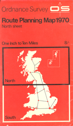
Ordnance Survey Route Planning Map
| Route Planning Map | |||
 | |||
| |||
| Publisher: | Ordnance Survey | ||
| Scale: | 1:625,000 | ||
| First Published: | 1964 | ||
| Final Publication: | present | ||
| SABRE Maps layer: | Yes | ||
The Ordnance Survey Route Planning Map series were the follow-up series to the Ten-Mile Road Map of Great Britain. Compared with the earlier maps they were generally less detailed, with fewer B-roads being shown, and very little detail in urban areas.
They covered Great Britain in two sheets, with Sheet 1 covering Scotland, and England south to roughly a line joining Ravenglass on the Cumberland coast with Ravenscar on the Yorkshire side. Some urban areas (depending on the map) were given expanded coverage, whilst later editions included junctions maps for limited access junctions on the motorway network. From 1973 onwards, the two sheets were available as a back-to-back printing in a single binding, with the back-to-back versions becoming standard from 1993 onwards.
They were published annually from 1964 to 1986, with later editions in 1988 and 1991 before being rebranded as Travelmaster: Great Britain Routeplanner series at the same scale, which were printed in 1993, 1997 and 1999.
The series had a revival in fortunes in 2000 with a return to annual printing, when they were again rebranded as Great Britain Routeplanner for the 2001 and 2002 editions, before settling on the Travel Map - Route name for the 2003 - 2009 editions.
In 2010, the series was discontinued, though the series saw a revival in 2017 as OS Route, but at a slightly different scale of 1:550,000.
SABRE Maps coverage
The earliest OS Route Planning Map was published in 1964, and so went out of copyright in 2015, and is now hosted on SABRE Maps. It is planned to host each annual Route Planning Maps layer on SABRE Maps when they become out-of-copyright, dependant upon availability.
| Ordnance Survey Route Planning Map | ||||||||
| ||||||||
| ||||||||
|


