Star.pngStar grey.pngStar grey.pngStar grey.pngStar grey.png

OSI Mapping

From Roader's Digest: The SABRE Wiki
(Redirected from Ordnance Survey Ireland)
Jump to navigation Jump to search
Cameraicon.png Pictures related to OSI Mapping
View gallery (9)

The Ordnance Survey of Ireland came into existence after the partition of Ireland. An Irish Government agency, it does for Ireland what the Ordnance Survey does for Great Britain.

List of Maps

A list of the changes to Ordnance Survey of Ireland mapping from 1921 to present.

Year From Year To Map Name Scale Notes
19?? present OSi Discovery 1:50000 Shared with OSNI

Links


OSI Mapping
Related Pictures
View gallery (9)
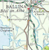
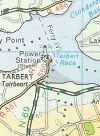
N57.pngN64.pngN79.pngR550Tarbert.jpgR609.jpg
Road Mapping
Ordnance SurveyMoT Maps • Ten Mile Road Map • Route Planning Map • One Inch(Popular Edition) • 1934 London PT • Landranger • Half Inch • Quarter Inch • Routemaster • Travelmaster • Road Map • Travel Map • Pathfinder • Explorer  • Outdoor Leisure • Tourist • Ten Mile • City Link • City, Town and Neighbourhood • Miniscale • OS Great Britain
Ordnance Survey Northern IrelandRoad Map • One Inch • Discoverer
Ordnance Survey IrelandDiscovery • Half Inch
Other MappingA-Z • AA • Bartholomew • Book of the Road • Google • Michelin • Philips • Others

SABRE - The Society for All British and Irish Road Enthusiasts
Discuss - Digest - Discover - Help